Continents of the World

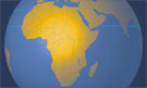
The Continent of Africa
The African states, with population figures.
Alphabetical list of the capitals of Africa.
The national flags of the countries of Africa.
List of African Languages by Countries.
The map shows the 54 independent states of Africa.
Relief Map of Africa.
Searchable map and satellite view of the Black Continent - find any place in Africa.
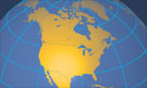
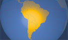
The Continents of the Americas
The countries of the Americas, the population, and the capital cities of the Americas.
Alphabetical list of the capitals of the Americas.
The national flags of the nation-states of the Americas.
The flags of the U.S. states.
List of Languages of the Americas and the Caribbean by Countries.
Reference Map of Central America and the Caribbean.
Reference Map of North America.
Reference Map of South America.
Map of the continental USA.
Blank Map of the continental USA.
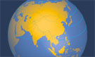
The Continent of Asia
The states of Asia, the population, and the capital cities of Asia.
Alphabetical list of Asia's capitals.
The national flags of the countries of Asia.
List of Asian Languages by Countries.
Reference Map of Asia.
Map of Western Asia and the Middle East region.
Map of the Southeast Asia region.
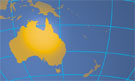
The Continent of Australia and Oceania
The Australian/Oceanian states, the population of the Australian/Oceanian states and the capital cities of the continent.
Alphabetical list of the capital cities of Australia and Oceania.
The national flags of the nation-states of Australia and Oceania.
List of Languages of Australian/Oceanian countries.
Reference Map of the Australia/Oceania region.
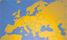
The Continent of Europe
The European states, the population of the European countries, and the capital cities of Europe.
Alphabetical list of the capital cities of Europe.
The national flags of the states of Europe.
List of European Languages by Countries.
Political Map of Europe.
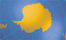
The Continent of Antarctica
A physical Map of Antarctica.
Satellite View of Antarctica using Google Earth Data.
Land and Oceans
Where the land meets the ocean, there is the beach. Beyond the beach, it gets even more interesting. The beach is a tiny part of the Continental Shelf, a broad, relatively shallow underwater terrace that is part of the continental crust.
If you move further away from the coast, you will get to a kind of cliff at the end of the terrace. The slope is known as the Continental Slope, where the shelf drops down to the ocean floor. When you follow the underwater scarp, you reach the Abyssal Plain, a vast flat seafloor area hundreds of kilometers wide and thousands of kilometers long, at depths of 3,000 to 6,000 m (10,000 to 20,000 feet).
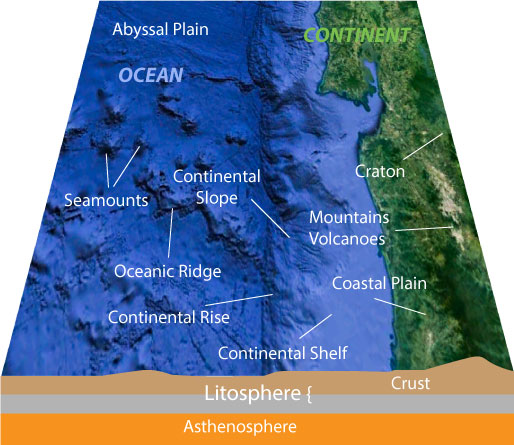
Coastal Zone with coastal plain (on land), continental shelf (under water), continental slope and abyssal plain.

The Formation of Continents
The formation of continents takes time, a long time; it takes millions of years. The various plates of the lithosphere are moving with a speed of 3 to 20 cm (1 to 8 inches) per year relative to each other. The driving forces behind the process of continents to move around across the Earth's surface is not yet fully understood.
Theory 1: large scale convection currents in the mantle, the heating and cooling of mantle matter, develop enough power to move the plates.
Theory 2: plumes, jets of partially molten rock material, rising to the Earth's surface at the ocean floor between mid-ocean ridges, adding matter to the crust, and pushing the plates in opposite directions.
The various tectonic plates may move apart at oceanic ridges, collide at subduction zones, or slide past one another along fault lines.
Pangaea
It is assumed that supercontinents have arranged and broken apart multiple times in Earth's geologic past.
Imagine, recently, about 300 million years ago, during the late Paleozoic and early Mesozoic eras, the world was separated - again, in Land (Pangaea) and Water (Panthalassa). Pangaea was a cluster of most or all of Earth's continental blocks combined in one mammoth continent, surrounded by an ocean that occupied almost 70% of Earth's surface.
In contrast to today's distribution of continents, the larger portion of Pangaea was in the southern hemisphere.

The breakup of the Pangaea Supercontinent over time.

'New' Continents
Zealandia - Te Riu-a-Māui
Zealandia is a mainly submerged continental fragment in the Pacific Ocean that was formerly part of Gondwana. It broke away from Australia 60–85 million years ago. Zealandia is about half the size of Australia. Not submerged portions of the continent are known as New Zealand with its outlying islands, New Caledonia, and some island territories of Australia, including the Lord Howe Islands and Norfolk Island.
Geologists from New Zealand, New Caledonia, and Australia concluded that Zealandia fulfills all the necessary requirements to be considered a continent* (albeit there are only some islands) it would be the world's smallest continent.
* a continent is defined as a large, continuous, discrete mass of land
(Further readings: Zealandia: Earth's Hidden Continent)


How many Continents are there in the world?
 Five continents
We have been taught in school (way back in the '60s in Europe) that there are five continents, Africa, America, Asia, Australia, and Europe, for instance symbolized in the five rings of the Olympic Games.
Six continents
However, there is no standard definition for the number of continents. In Europe, many students are taught about six continents, in which North and South America is combined to form a single America.
These six continents are Africa, America, Antarctica, Asia, Australia/Oceania, and Europe.
Seven continents
By most standards, there is a maximum of seven continents - Africa, Antarctica, Asia, Australia/Oceania, Europe, North America, and South America. Many geographers and scientists now refer to six continents, in which Europe and Asia are combined (because they're one solid landmass).
These six continents are then Africa, Antarctica, Australia/Oceania, Eurasia, North America, and South America.
Is Oceania a continent?
Actually, by the definition of a continent as a large continuous area of land, the South Pacific Islands of Oceania aren't a continent. Still, one could say they belong to a continent, e.g., Oceania is sometimes associated with the continent of Australia.
We have been taught in school (way back in the '60s in Europe) that there are five continents, Africa, America, Asia, Australia, and Europe, for instance symbolized in the five rings of the Olympic Games.
However, there is no standard definition for the number of continents. In Europe, many students are taught about six continents, in which North and South America is combined to form a single America.
These six continents are Africa, America, Antarctica, Asia, Australia/Oceania, and Europe.
By most standards, there is a maximum of seven continents - Africa, Antarctica, Asia, Australia/Oceania, Europe, North America, and South America. Many geographers and scientists now refer to six continents, in which Europe and Asia are combined (because they're one solid landmass).
These six continents are then Africa, Antarctica, Australia/Oceania, Eurasia, North America, and South America.
Is Oceania a continent?
Actually, by the definition of a continent as a large continuous area of land, the South Pacific Islands of Oceania aren't a continent. Still, one could say they belong to a continent, e.g., Oceania is sometimes associated with the continent of Australia.
Advertisement

The Olympic Rings, a Symbol that represents the 5 (inhabited) continents of the world: Africa, America, Asia, Europe, and Oceania/Australia.
The rings were designed in 1912 by Pierre de Coubertin the "father" of the modern Olympic Games.

Comments
Post a Comment